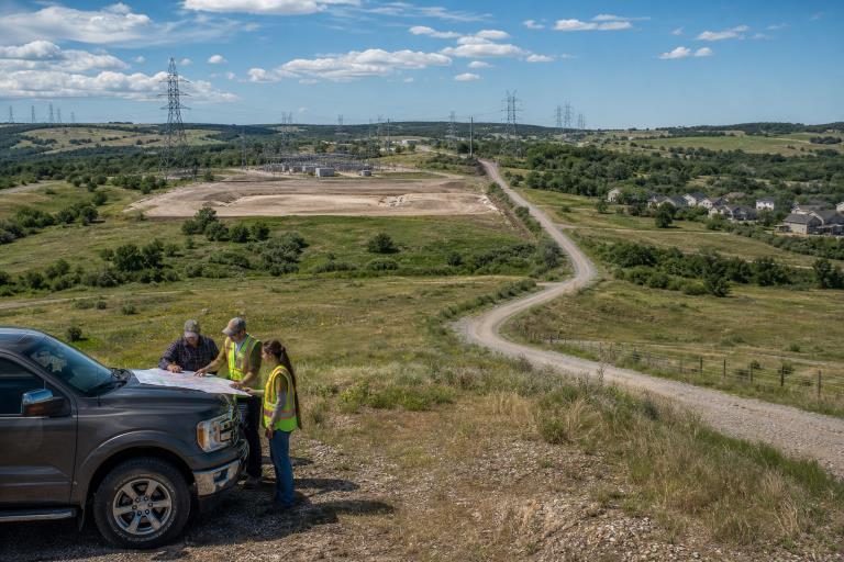
Energy, utility, and infrastructure projects succeed or fail long before equipment reaches the site. A careful land review helps teams understand who controls a property, what uses are allowed, where access exists, and which environmental or community factors could reshape the plan. Professionals seeking a stronger foundation in these issues may benefit from a land management certificate that covers the practical relationship among land rights, leases, records, and energy development. In 2026, early diligence is especially important because projects often involve overlapping rights, evolving local rules, grid constraints, public scrutiny, and complex permitting paths. A location that looks ideal on a parcel map may still have a title defect, a restricted road crossing, a drainage easement, or zoning limits that make the original design unworkable.
Why Land Use Review Matters In 2026
A project footprint can involve more than one parcel and multiple types of legal rights. Surface use, mineral rights, utility corridors, water access, road use, drainage, and habitat protections may all apply to the same area. If one issue is discovered late, it can affect budgets, construction sequencing, financing, permit applications, and relationships with nearby landowners. For example, a proposed battery facility may be close to a substation and highway, but the preferred entrance could cross private land without a recorded access right. The team may need a new easement, a different road design, or a revised site plan. Early review turns these surprises into decisions instead of emergencies.
The Records To Check Before A Land Deal
A site visit is essential, but it cannot reveal every legal or regulatory issue. Start with county assessor and recorder records, recorded deeds, tax status, surveys, legal descriptions, existing leases, options, permits, notices of violation, and agreements for pipelines, utilities, drainage, or access.
First-Pass File Review
- Match the parcel number, owner name, acreage, and legal description across available records.
- Request the latest survey and identify visible boundary or fence conflicts.
- List recorded easements, leases, liens, restrictions, and rights of way.
- Check whether taxes are current and whether prior permits remain active.
- Record missing documents and assign an owner for each follow-up item.
Ownership, Title, And Mineral Rights
Surface ownership grants a party rights to the land itself, while mineral ownership grants rights to oil, gas, minerals, and other subsurface resources. A working interest generally relates to operational rights under a lease, a royalty interest provides a share of production revenue, and a leasehold interest gives defined rights for a stated term. Different people or entities can hold these interests. A complete chain of title helps reveal old reservations, estate transfers, missing signatures, unclear legal descriptions, and prior conveyances that may affect the project. Review title questions before negotiations become expensive. The essential questions are simple: Who owns the land now? Who controls the subsurface? Are leases active? Are there liens, probate issues, or boundary disputes?
Zoning, Permits, And Local Rules
Owning or leasing land does not automatically authorize a proposed use. Review the zoning map and land-use code to determine whether the project is allowed by right or requires a conditional use permit, special use approval, variance, hearing, or site plan review. Also identify setback, height, lighting, noise, road, fire, and safety standards. Authority may be shared among city, county, state, federal, and utility entities. Local rules can also change during project development. For example, local land-use review processes show how public processes can examine water and energy demand, transportation capacity, noise, environmental impacts, emergency response, and concerns from nearby property owners before new development standards are adopted.
Easements, Access, And Infrastructure
Easements can authorize roads, transmission lines, pipelines, water lines, communications facilities, or drainage improvements. A permanent easement usually grants ongoing use, while a temporary construction easement supports limited work. Rights of way and licenses may also provide access, but their terms and durability can differ significantly. Confirm that the site has both legal and practical access from a public road. Ask whether heavy construction traffic can use the route, whether crossings require separate approvals, who maintains the road, whether emergency vehicles can enter, and whether existing easements conflict with the project footprint. Check power, water, communications, and interconnection capacity early rather than treating them as assumptions.
Environmental And Community Review
Screen for wetlands, waterways, flood risks, soil limitations, wildlife habitat, cultural resources, nearby residences, and visual effects before selecting a final site. Environmental constraints do not always stop development, but they may require redesign, seasonal work limits, additional studies, mitigation measures, or agency approvals. Community engagement works best when it begins with clear facts. Provide readable maps, anticipated traffic routes, construction timing, noise controls, water plans, safety contacts, and specific mitigation commitments. Listening early can identify concerns that technical teams may not see from desktop records alone.
How GIS Supports Better Decisions
Geographic information systems can combine parcel boundaries, ownership records, roads, utility corridors, water features, protected areas, surveys, and proposed layouts into one working view. Teams should create a verified base map, label every layer with its source and date, and distinguish confirmed information from assumptions. For teams improving field-to-office coordination, this GIS data management guidance offers useful context on organizing spatial data, developing workforce skills, and maintaining information that supports operational decisions.
A Step-By-Step Review Process
- Define the main site, roads, utility routes, staging areas, and potential expansion areas.
- Collect core records, including deeds, surveys, leases, easements, zoning maps, and permit history.
- Confirm ownership and map restrictions against the proposed footprint.
- Contact relevant agencies to clarify review paths, timelines, and application requirements.
- Document community concerns, rank risks, and maintain one decision file for maps, approvals, and open items.
- Recheck records and rules before closing a transaction or beginning construction.
Common Mistakes That Create Delays
- Relying on old surveys or parcel maps.
- Assuming the surface owner controls all mineral rights.
- Overlooking narrow easements or road-crossing requirements.
- Waiting too long to speak with planning staff or utility providers.
- Using inconsistent parcel numbers, owner names, or legal descriptions.
- Leaving environmental screening and public communication until late in the process.
A Practical 2026 Checklist
- Ownership:Identify every current owner and interest holder.
- Title:Review the chain of title for reservations, liens, and gaps.
- Access:Confirm legal, buildable, and maintainable site access.
- Zoning:Verify that the use is permitted and list required approvals.
- Environment:Screen water, wildlife, soil, flood, and cultural resource issues.
- Community:Document local concerns and project-specific mitigation measures.
- Records:Keep the latest maps, documents, and agency communications in one accessible system.
Conclusion
Energy projects depend on more than engineering and capital. Clear land rights, accurate records, workable access, realistic permitting, and transparent communication are equally important to keeping projects on schedule and within budget. Early coordination among landowners, developers, consultants, and regulatory agencies can help identify potential obstacles before construction begins. A disciplined land-use review takes time at the beginning, but it provides project teams with the information needed to make informed decisions, manage risk, and reduce costly surprises later. Investing in thorough planning and documentation from the outset creates a stronger foundation for efficient project execution, regulatory compliance, and long-term operational success.